Rechter Gallery
Come Visit The Rechter Gallery Today!


Come Visit The Rechter Gallery Today!

Ever wonder how many cows your great great grandfather owned? Did they raise apples or potatoes? Did they manage the local mill and employ workers? Maybe grandma ran the local hattery? Ancestry.com and many other resources provide the “manuscript” census schedules for use with family history but most have not digitized and made available the hand-written schedules from the “non-population” census surveys. These schedules collected, frequently by the same census taker, collected data on industrial, agricultural, and social development. As early as 1810 the nation was interested in manufacturing establishments, but not until 1840 were printed schedules, entitled “Schedules of Mines, Agriculture, Commerce, Manufacturers, etc.” used, and not until 1850 was the statistical methodology considered successful.
[…]

One of the earliest and most requested items we have at the Monroe County History Center’s Research Library is entitled “A New Gazetteer Map of Monroe County, Indiana” dated 1856. We link to a few of our favorite maps on our web page, but there are a couple of other online sources for early Indiana and Bloomington and Monroe County maps.
Indiana Historic Maps includes more than 1200 scanned maps from Indiana, including more than 43 from Bloomington/Monroe County. Most date before 1923 so copyright is not a question, but other maps in the public domain are included when possible. Like the 1856 map mentioned above, there are maps from 1920 (Van Buskirk), 1930 (Clevenger), and 1950 (Stapleton) that indicate land owners or cadastral maps. One of my favorite maps of A Road Map of Monroe County by the Indiana Geological Survey dates to 1906 before roads were “numbered”. Another is the Detail Geological Map of the Vicinity of Bloomington, Indiana dated 1896 showing Hunter Valley.
[…]

In the newspaper collection at the MCHC Research Library, we have numerous issues of The Optimist, the newspaper of Bloomington High School (later Bloomington High School South). The paper according to Wikipedia https://en.wikipedia.org/wiki/Bloomington_High_School_South began in 1911. Our holdings appear to be the most complete with scattered issues from 1923 through 2009 (see Index for specific holdings). According to WorldCat, two other libraries have some holdings:
I did not verify whether a complete run exists at MCCSC (Phone: 812-330-7700).
[…]

Bloomington draws people from many places. One longtime resident who began life not far from here in Columbus, Indiana was Bessie Lynn Hufford, wife of IU Physics Professor Dr. Mason Edward Hufford (1882-1975). Among Mrs. Hufford’s interests were gardening and genealogy. Her persistent search for her ancestors resulted in reams of correspondence with people around the country, and she saved all of her records. The collection was donated to the MCHC in 2000, but for many years remained in storage. It was recently sorted and a few items were placed in the Lynn file in our Family Files. Close relatives were mostly from Bartholomew and Lawrence Counties, so the bulk of the items were sent to the historical societies in Columbus and Bedford. Family names she was researching included Childs, (Chiles), Dixon, Edwards, Eversole, Hufford, Jackson, King, Kinnett, McCoy, Warnick, and Waters.
[…]

June is Limestone Month in Monroe County Indiana and what an excellent time to remind everyone of the magnificent contributions the limestone industry has made to our county. For a list of events, see this calendar.
The MCHC Cemetery Committee is hosting two events:

Stone at White Oak Cemetery
[…]
This index, compiled by Lee Ehman, contains all of the original sales of Monroe County land from U.S. Land Offices during the 1800’s. It was compiled from the searchable online database maintained by the U.S. Bureau of Land Management. This index augments information from the Research Library’s index of Monroe County land records from Deed […]
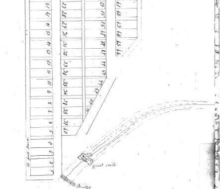
Both David Lemon and Randi Richardson (the MCHC Library Volunteer of the Year) mentioned that they had seen information about the layout or plat maps of various towns within the Monroe County Land Records. I did some searching on the MCHC Research Library’s index: Land Records Index (c. 1811- 1870) and was pleasantly surprised. Thus far, I have found plat maps for Bloomington, Seminary Square, Graham’s Reserve, Ellettsville, Mount Tabor, Palestine, Fleeners Burg, Buena Vista, Unionville, Chapel Hill, Wayport, and Smithville plus several “additions.”
Because the Cemetery Committee had worked on the Mount Tabor Cemetery (Switzer/Hite) recently, I will use it as an example. The map featured in this post appears on C87 in Deed Book C. Located in Bean Blossom Township, Mount Tabor was quite a village between 1820 and 1850.
[…]
This new index is a compilation of indexes to original birth records created at the Monroe County Health Department and edited by Lee Ehman (library volunteer). This index currently is not in print form, but can be found on our website. Of note for family researchers is the entry for mother’s maiden name, a sometimes […]
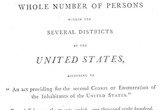
As we prepare to celebrate the Indiana Bicentennial in 2016, and Monroe County’s Bicentennial in 2018, it is interesting to look back at the growth in our population. Congress is mandated by the Constitution to take an enumeration every ten years for apportionment of the House of Representatives, thus we have the U.S. Census. The first was taken in 1790. The early census records were really a basic count of the voting population (i.e. white men over 18 years of age). Throughout the decades, additional questions have been added. (My favorite brief history is “History and Organization” CFF-4 of the Factfinder for the Nation series: https://www.census.gov/history/pdf/cff4.pdf).
[…]


